Using a height map or a boolean matrix, generates a semi-transparent waterline overlay to
layer onto an existing map. This uses the method described by P. Felzenszwalb & D. Huttenlocher in
"Distance Transforms of Sampled Functions" (Theory of Computing, Vol. 8, No. 19, September 2012)
to calculate the distance to the coast. This distance matrix can be returned directly by setting
the return_distance_matrix argument to TRUE.
generate_waterline_overlay(
  heightmap,
  color = "white",
  linewidth = 1,
  boolean = FALSE,
  min = 0.001,
  max = 0.2,
  breaks = 9,
  smooth = 0,
  fade = TRUE,
  alpha_dist = max,
  alpha = 1,
  falloff = 1.3,
  evenly_spaced = FALSE,
  zscale = 1,
  cutoff = 0.999,
  width = NA,
  height = NA,
  resolution_multiply = 1,
  min_area = length(heightmap)/400,
  max_height = NULL,
  return_distance_matrix = FALSE
)
Arguments
- heightmap
A two-dimensional matrix, where each entry in the matrix is the elevation at that point. If
boolean = TRUE, this will instead be interpreted as a logical matrix indicating areas of water.- color
Default
white. Color of the lines.- linewidth
Default
1. Line width.- boolean
Default
FALSE. IfTRUE, this is a boolean matrix (0 and 1) indicating contiguous areas in which the lines are generated (instead of a height matrix, from which the boolean matrix is derived usingdetect_water())- min
Default
0.001. Percent distance (measured from the furthest point from shore) where the waterlines stop.- max
Default
0.2. Percent distance (measured from the furthest point from shore) where the waterlines begin.- breaks
Default
9. Number of water lines.- smooth
Default
0, no smoothing. Increase this to smooth water lines around corners.- fade
Default
TRUE. IfFALSE, lines will not fade with distance from shore.- alpha_dist
Default to the value specified in
max. Percent distance (measured from the furthest point from shore) where the waterlines fade entirely, whenfade = TRUE.- alpha
Default
1. Maximum transparency for waterlines. This scales the transparency for all other levels.- falloff
Default
1.3. Multiplicative decrease in distance between each waterline level.- evenly_spaced
Default
FALSE. IfTRUE,falloffwill be ignored and the lines will be evenly spaced.- zscale
Default
1. Arguments passed todetect_water(). Ignored ifboolean = TRUE. The ratio between the x and y spacing (which are assumed to be equal) and the z axis. For example, if the elevation levels are in units of 1 meter and the grid values are separated by 10 meters,zscalewould be 10.- cutoff
Default
0.999. Arguments passed todetect_water(). Ignored ifboolean = TRUE.The lower limit of the z-component of the unit normal vector to be classified as water.- width
Default
NA. Width of the resulting image array. Default the same dimensions as height map.- height
Default
NA. Width of the resulting image array. Default the same dimensions as height map.- resolution_multiply
Default
1. If passing inheightmapinstead of width/height, amount to increase the resolution of the overlay, which should make lines/polygons/text finer. Should be combined withadd_overlay()withrescale_original = TRUEto ensure those added details are captured in the final map.- min_area
Default
length(heightmap)/400. Arguments passed todetect_water(). Ignored ifboolean = TRUE. Minimum area (in units of the height matrix x and y spacing) to be considered a body of water.- max_height
Default
NULL. Arguments passed todetect_water(). Ignored ifboolean = TRUE. If passed, this number will specify the maximum height a point can be considered to be water.FALSE, the direction will be reversed.- return_distance_matrix
Default
FALSE. IfTRUE, this function will return the boolean distance matrix instead of contour lines.
Value
4-layer RGB array representing the waterline overlay.
Examples
if(run_documentation()) {
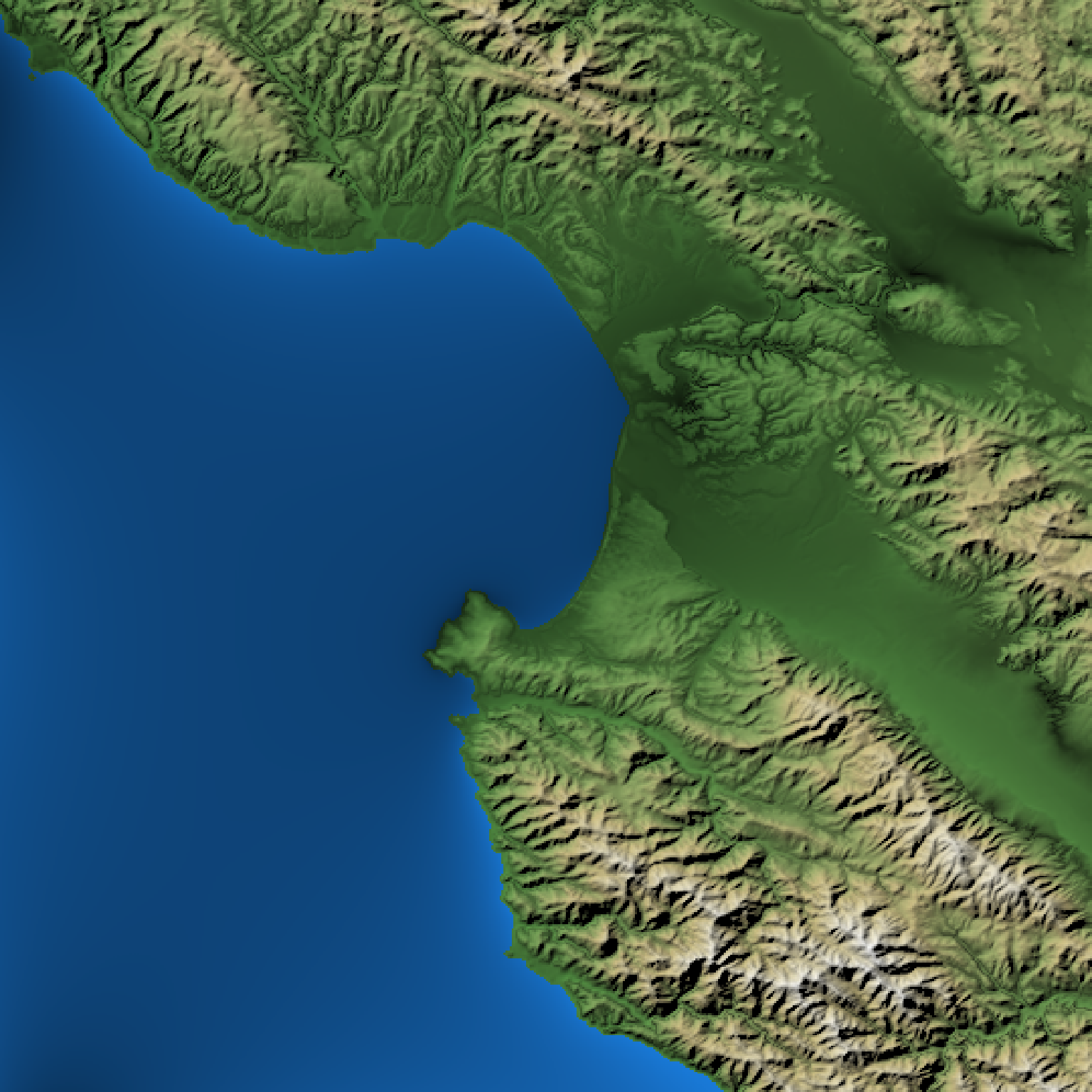
#Create a flat body of water for Monterey Bay
montbay = montereybay
montbay[montbay < 0] = 0
#Generate base map with no lines
basemap = montbay |>
height_shade() |>
add_water(detect_water(montbay), color="dodgerblue") |>
add_shadow(texture_shade(montbay, detail=1/3, brightness = 15, contrast = 5),0) |>
add_shadow(lamb_shade(montbay,zscale=50),0)
plot_map(basemap)
}
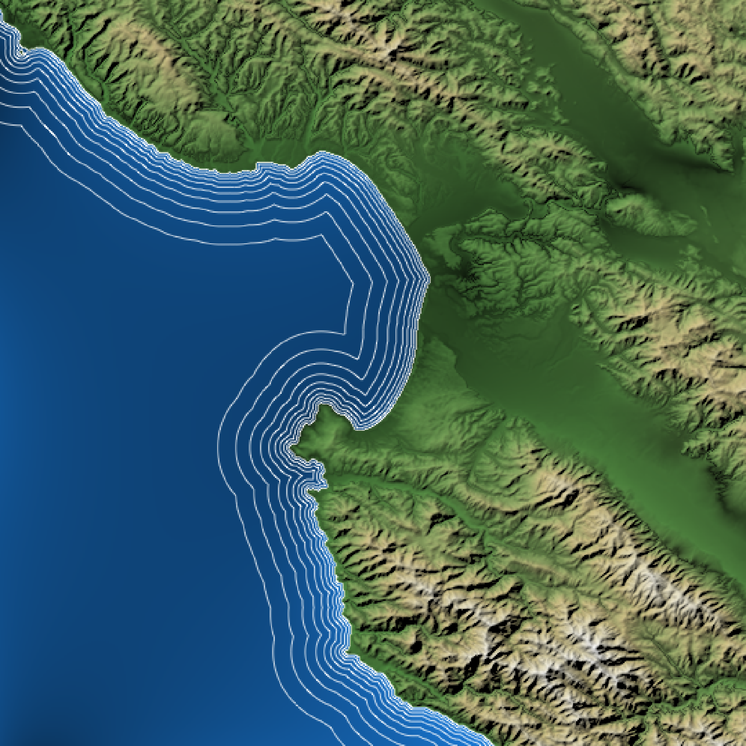
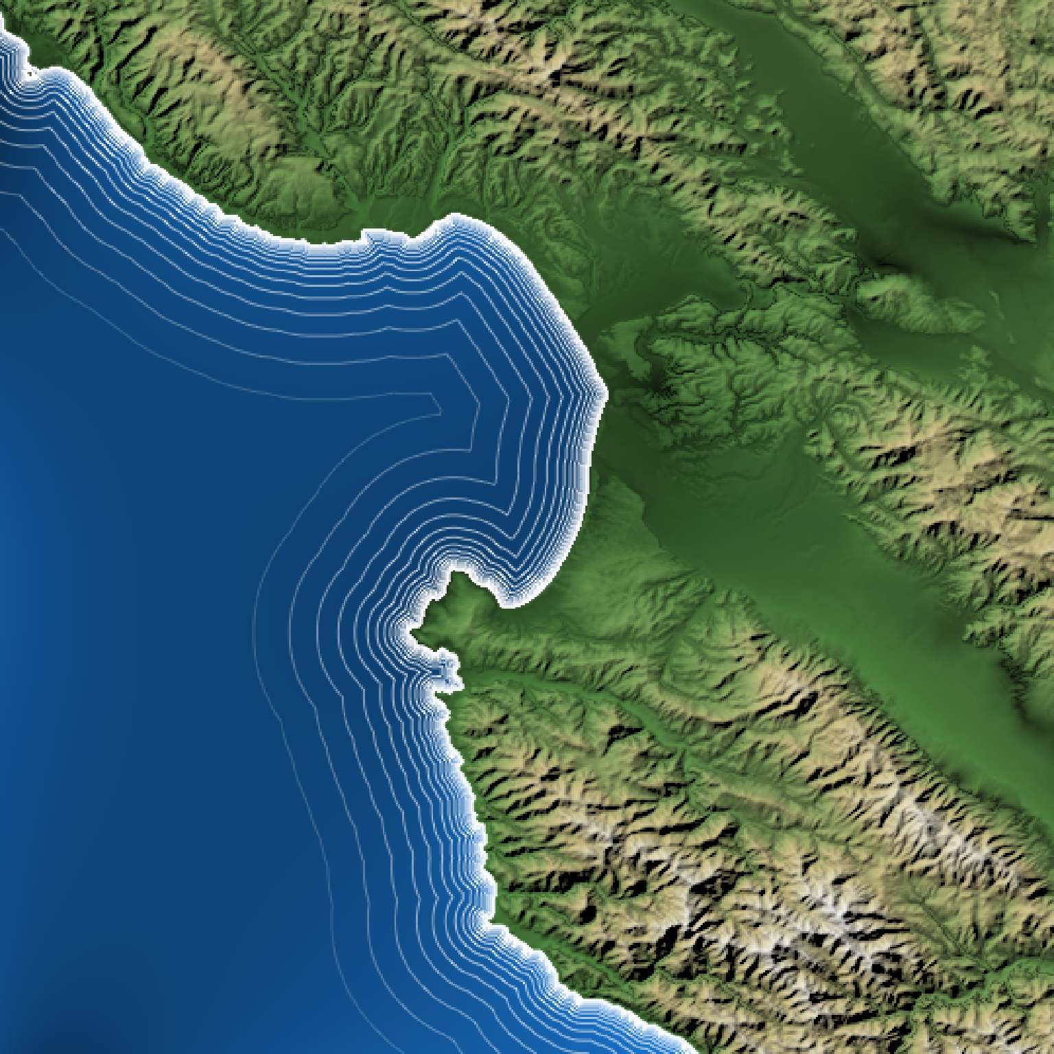
 if(run_documentation()) {
#Add waterlines
basemap |>
add_overlay(generate_waterline_overlay(montbay)) |>
plot_map()
}
if(run_documentation()) {
#Add waterlines
basemap |>
add_overlay(generate_waterline_overlay(montbay)) |>
plot_map()
}
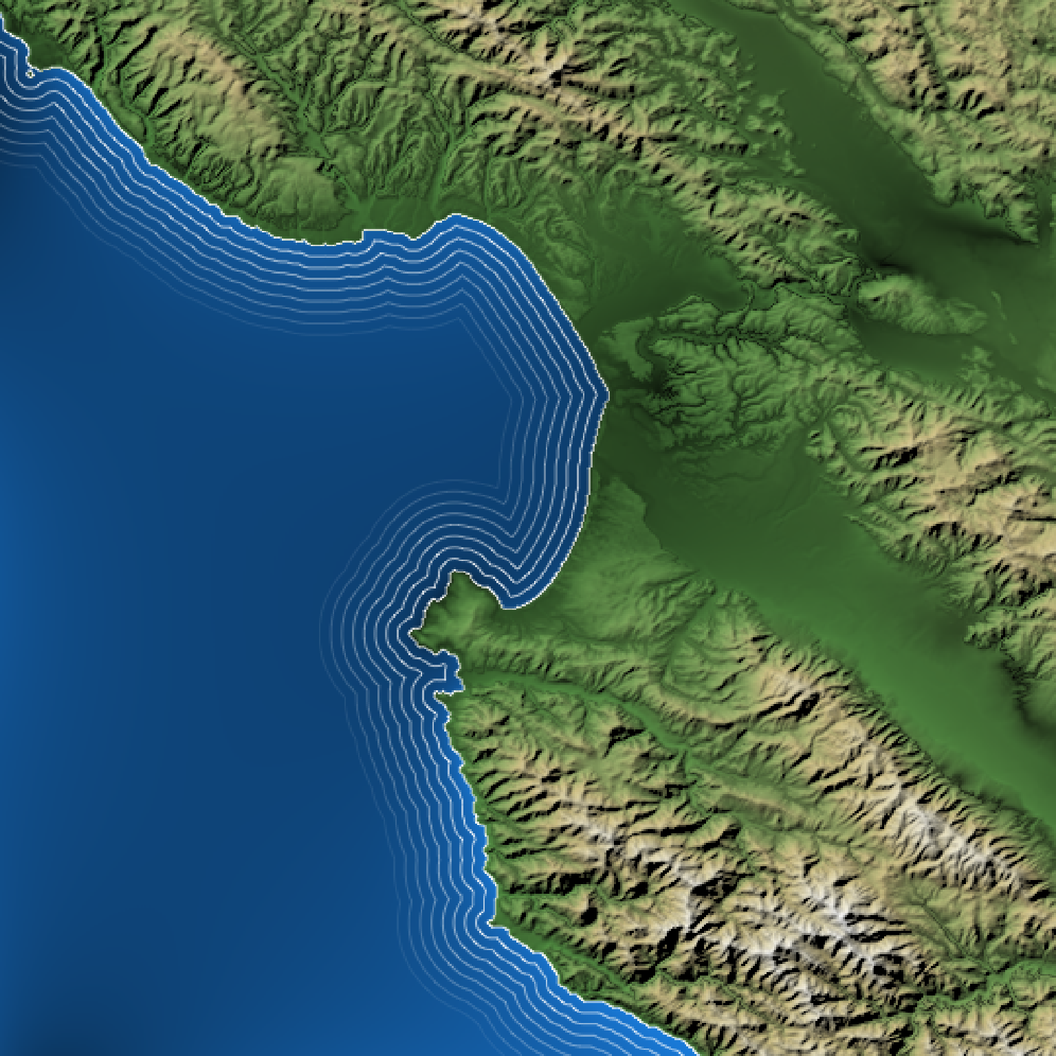
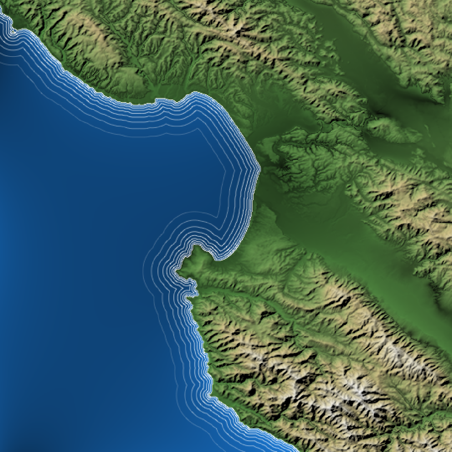 if(run_documentation()) {
#Change minimum line distance:
basemap |>
add_overlay(generate_waterline_overlay(montbay, min = 0.02)) |>
plot_map()
}
if(run_documentation()) {
#Change minimum line distance:
basemap |>
add_overlay(generate_waterline_overlay(montbay, min = 0.02)) |>
plot_map()
}
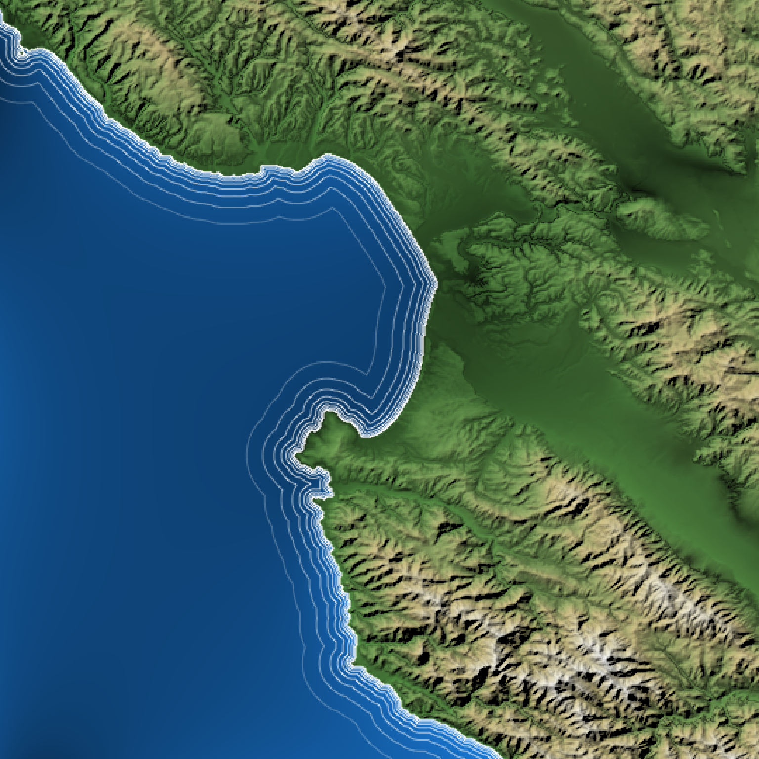
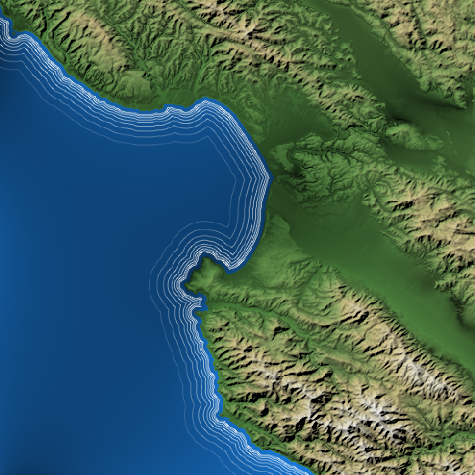 if(run_documentation()) {
#Change maximum line distance
basemap |>
add_overlay(generate_waterline_overlay(montbay, max = 0.4)) |>
plot_map()
}
if(run_documentation()) {
#Change maximum line distance
basemap |>
add_overlay(generate_waterline_overlay(montbay, max = 0.4)) |>
plot_map()
}
 if(run_documentation()) {
#Smooth waterlines
basemap |>
add_overlay(generate_waterline_overlay(montbay, max = 0.4, smooth=2)) |>
plot_map()
}
#> Error in UseMethod("rescale"): no applicable method for 'rescale' applied to an object of class "c('rayimg', 'matrix', 'array')"
if(run_documentation()) {
#Increase number of breaks
basemap |>
add_overlay(generate_waterline_overlay(montbay, breaks = 20, max=0.4)) |>
plot_map()
}
if(run_documentation()) {
#Smooth waterlines
basemap |>
add_overlay(generate_waterline_overlay(montbay, max = 0.4, smooth=2)) |>
plot_map()
}
#> Error in UseMethod("rescale"): no applicable method for 'rescale' applied to an object of class "c('rayimg', 'matrix', 'array')"
if(run_documentation()) {
#Increase number of breaks
basemap |>
add_overlay(generate_waterline_overlay(montbay, breaks = 20, max=0.4)) |>
plot_map()
}
 if(run_documentation()) {
#Make lines evenly spaced:
basemap |>
add_overlay(generate_waterline_overlay(montbay, evenly_spaced = TRUE)) |>
plot_map()
}
if(run_documentation()) {
#Make lines evenly spaced:
basemap |>
add_overlay(generate_waterline_overlay(montbay, evenly_spaced = TRUE)) |>
plot_map()
}
 if(run_documentation()) {
#Change variable distance between each line
basemap |>
add_overlay(generate_waterline_overlay(montbay, falloff=1.5)) |>
plot_map()
}
if(run_documentation()) {
#Change variable distance between each line
basemap |>
add_overlay(generate_waterline_overlay(montbay, falloff=1.5)) |>
plot_map()
}
 if(run_documentation()) {
#Turn off fading
basemap |>
add_overlay(generate_waterline_overlay(montbay, fade=FALSE)) |>
plot_map()
}
if(run_documentation()) {
#Turn off fading
basemap |>
add_overlay(generate_waterline_overlay(montbay, fade=FALSE)) |>
plot_map()
}
 if(run_documentation()) {
#Fill up the entire body of water with lines and make them all 50% transparent
basemap |>
add_overlay(generate_waterline_overlay(montbay, fade=FALSE, max=1, alpha = 0.5, color="white",
evenly_spaced = TRUE, breaks=50)) |>
plot_map()
}
if(run_documentation()) {
#Fill up the entire body of water with lines and make them all 50% transparent
basemap |>
add_overlay(generate_waterline_overlay(montbay, fade=FALSE, max=1, alpha = 0.5, color="white",
evenly_spaced = TRUE, breaks=50)) |>
plot_map()
}