Adds 3D polygons to the current scene, using latitude/longitude or coordinates in the reference system defined by the extent object.
render_polygons(
  polygon,
  extent,
  color = "red",
  top = 1,
  bottom = NA,
  data_column_top = NULL,
  data_column_bottom = NULL,
  heightmap = NULL,
  scale_data = 1,
  parallel = FALSE,
  holes = 0,
  alpha = 1,
  lit = TRUE,
  light_altitude = c(45, 30),
  light_direction = c(315, 135),
  light_intensity = 0.3,
  light_relative = FALSE,
  clear_previous = FALSE
)
Arguments
- polygon
sfobject, "SpatialPolygon"spobject, or xy coordinates of polygon represented in a way that can be processed byxy.coords(). If xy-coordinate based polygons are open, they will be closed by adding an edge from the last point to the first.- extent
Either an object representing the spatial extent of the 3D scene (either from the
raster,terra,sf, orsppackages), a length-4 numeric vector specifyingc("xmin", "xmax", "ymin", "ymax"), or the spatial object (from the previously aforementioned packages) which will be automatically converted to an extent object.- color
Default
black. Color of the polygon.- top
Default
1. Extruded top distance. If this equalsbottom, the polygon will not be extruded and just the one side will be rendered.- bottom
Default
0. Extruded bottom distance. If this equalstop, the polygon will not be extruded and just the one side will be rendered.- data_column_top
Default
NULL. A string indicating the column in thesfobject to use to specify the top of the extruded polygon.- data_column_bottom
Default
NULL. A string indicating the column in thesfobject to use to specify the bottom of the extruded polygon.- heightmap
Default
NULL. Automatically extracted from the rgl window–only use if auto-extraction of matrix extent isn't working. A two-dimensional matrix, where each entry in the matrix is the elevation at that point. All points are assumed to be evenly spaced.- scale_data
Default
1. If specifyingdata_column_topordata_column_bottom, how much to scale that value when rendering.- parallel
Default
FALSE. IfTRUE, polygons will be extruded in parallel, which may be faster (depending on how many geometries are inpolygon).- holes
Default
0. If passing in a polygon directly, this specifies which index represents the holes in the polygon. See theearcutfunction in thedecidopackage for more information.- alpha
Default
1. Transparency of the polygons.- lit
Default
TRUE. Whether to light the polygons.- light_altitude
Default
c(45, 60). Degree(s) from the horizon from which to light the polygons.- light_direction
Default
c(45, 60). Degree(s) from north from which to light the polygons.- light_intensity
Default
0.3. Intensity of the specular highlight on the polygons.- light_relative
Default
FALSE. Whether the light direction should be taken relative to the camera, or absolute.- clear_previous
Default
FALSE. IfTRUE, it will clear all existing polygons.
Examples
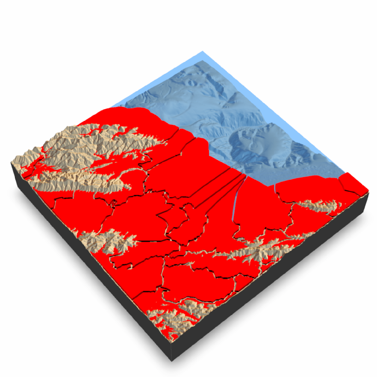
if(run_documentation()) {
#Render the county borders as polygons in Monterey Bay
montereybay |>
sphere_shade(texture = "desert") |>
add_shadow(ray_shade(montereybay,zscale = 50)) |>
plot_3d(montereybay, water = TRUE, windowsize = 800, watercolor = "dodgerblue")
render_camera(theta = 140, phi = 55, zoom = 0.85, fov = 30)
#We will apply a negative buffer to create space between adjacent polygons. You may
#have to call `sf::sf_use_s2(FALSE)` before running this code to get it to run.
sf::sf_use_s2(FALSE)
mont_county_buff = sf::st_simplify(sf::st_buffer(monterey_counties_sf,-0.003), dTolerance=0.001)
render_polygons(mont_county_buff,
extent = attr(montereybay,"extent"), top = 10,
parallel = FALSE)
render_snapshot()
}
#> `montereybay` dataset used with no zscale--setting `zscale=50`. For a realistic depiction, raise `zscale` to 200.
#> Warning: st_buffer does not correctly buffer longitude/latitude data
#> dist is assumed to be in decimal degrees (arc_degrees).
#> Warning: st_simplify does not correctly simplify longitude/latitude data, dTolerance needs to be in decimal degrees
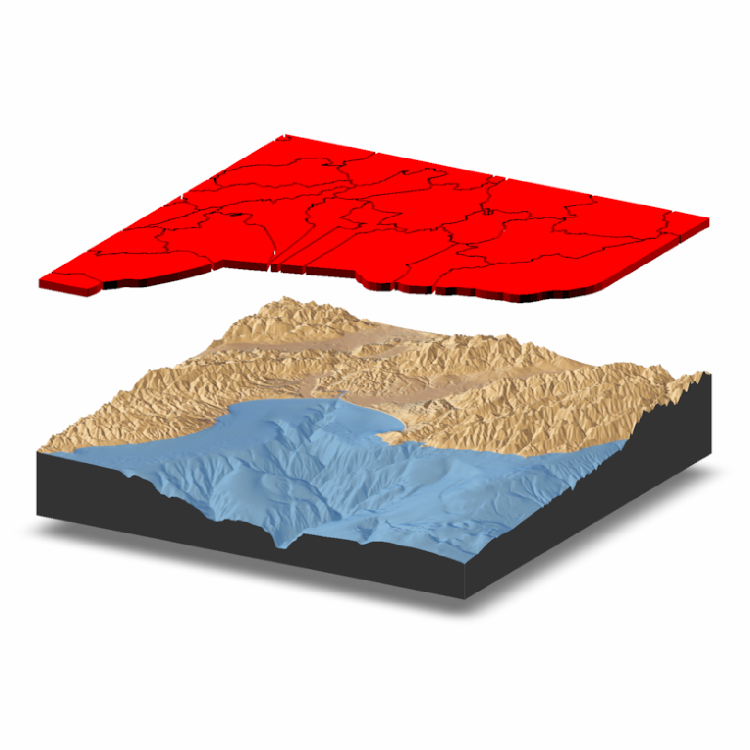
 if(run_documentation()) {
#We can specify the bottom of the polygons as well. Here I float the polygons above the surface
#by specifying the bottom argument. We clear the previous polygons with `clear_previous = TRUE`.
render_camera(theta=-60, phi=20, zoom = 0.85, fov=0)
render_polygons(mont_county_buff,
extent = attr(montereybay,"extent"), bottom = 190, top=200,
parallel=FALSE,clear_previous=TRUE)
render_snapshot()
}
if(run_documentation()) {
#We can specify the bottom of the polygons as well. Here I float the polygons above the surface
#by specifying the bottom argument. We clear the previous polygons with `clear_previous = TRUE`.
render_camera(theta=-60, phi=20, zoom = 0.85, fov=0)
render_polygons(mont_county_buff,
extent = attr(montereybay,"extent"), bottom = 190, top=200,
parallel=FALSE,clear_previous=TRUE)
render_snapshot()
}
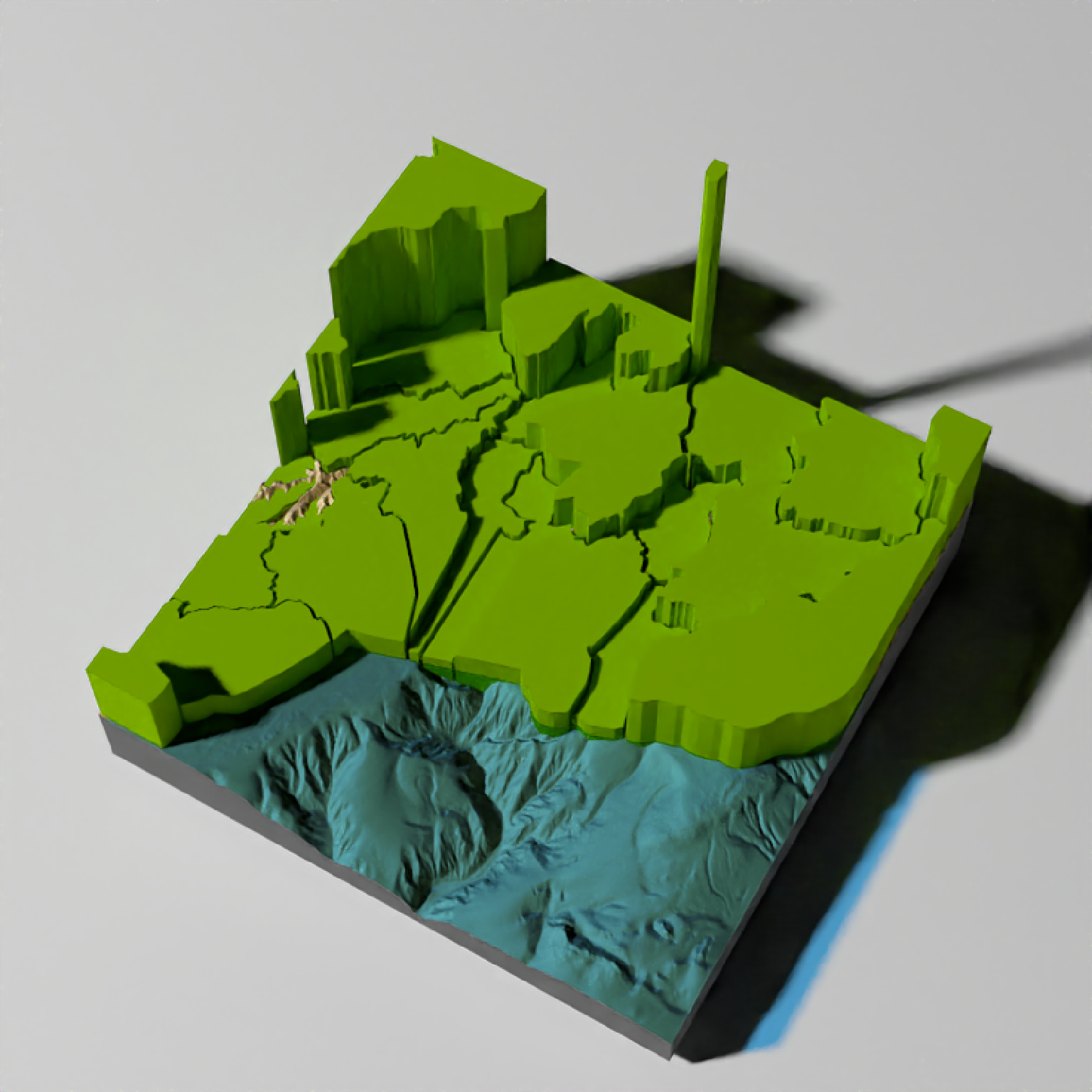
 if(run_documentation()) {
#We can set the height of the data to a column in the sf object: we'll use the land area.
#We'll have to scale this value because its max value is 2.6 billion:
render_camera(theta=-60, phi=60, zoom = 0.85, fov=30)
render_polygons(mont_county_buff,
extent = attr(montereybay, "extent"), data_column_top = "ALAND",
scale_data = 300/(2.6E9), color = "chartreuse4",
clear_previous = TRUE)
render_snapshot()
}
if(run_documentation()) {
#We can set the height of the data to a column in the sf object: we'll use the land area.
#We'll have to scale this value because its max value is 2.6 billion:
render_camera(theta=-60, phi=60, zoom = 0.85, fov=30)
render_polygons(mont_county_buff,
extent = attr(montereybay, "extent"), data_column_top = "ALAND",
scale_data = 300/(2.6E9), color = "chartreuse4",
clear_previous = TRUE)
render_snapshot()
}
 if(run_documentation()) {
#This function also works with `render_highquality()`
render_highquality(samples = 16, min_variance = 0)
}
if(run_documentation()) {
#This function also works with `render_highquality()`
render_highquality(samples = 16, min_variance = 0)
}